|
|
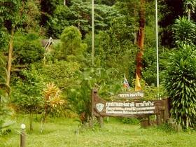
The park is a historical area the battle field between Chinese communist and the soldiers. The communist digged 40m deep tunnel as shelter and to keep weapon. Dues to the weather is cold all year, the park is named "Khao Nam Khang". The park's attractions are Ton Tat Fah, Wang Luang Prom, Pru Ching Waterfalls, Mueang Look Nueng and Khao Nam Khang tunnel. The park is consisting of complex mountain ranges stretched southward till the border of Malaysia. The significant mountains are Kuan Sya, Kuan Khao Mai and the highest mountain: Khao Nam Kang which is 648 meters in height above average sea level. It's an important area which originate many streams which are Na Twee canal, Prik canal, Tub Chang canal, Klong Sai Kaow canal, etc. Soil characteristic is friable soil, clay, clay mixed with sand, stone characteristic is mostly limestone and granite stone. Ton Lad Waterfall is the beautiful waterfall, about 50 m. long, located behind the Park Headquarter at about 500 m. Ton Dard Fa Waterfall has a steep slope cliff about 80-90 degree celsious, when have your face lifted, it's like beautiful deck. Nam Tok Wang Luang Prom is a small waterfall, with a lage stone in the center of waterfall,cousing 2 currents of water. Muang Luk Nung Muang Luk Nung, a large boulder which give the appearance of a mighty wall surrounding an ancient city. It's located in approximately area of Nam Kang Summit. Pru Ching Waterfall is highest waterfall in Khao Nam Khang mountain. Nam Tok Ton Mai Pak at Sadao district in SongKla province, is most beautiful waterfall and has strong water flows. |