|
|
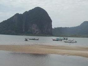
The coastline of Trang in total extends for over 120 km. And has historically been inhabited by sea fishermen whose houses were built at the mouths of streams and rivers flowing into the sea. These people had an simple easy life, fishing and harvesting produce from there surroundings. The coast of Trang is dominated by beaches of the finest quality sand, clear water and a plentiful unspoilt coastal forest. The coastal zone is very natural. This natural unspoilt environment is the last remaining refuge of the strange marine mammal, the Dugong in Thailand. The Dugong is one of the fifteen reserved animals of Thailand, species which have been adopted by the people, because they are endangered, and require special efforts to ensure there survival in the future. Hat Chao Mai National Park consists of land area and sea area, located in the western side of southern part of Thailand. It covers land area about 93.64 sq.km and sea area of Andaman sea in Indian ocean about 137.21 sq.km. This national park is divided into 2 parts, the first part is the coast land including Muk island, Kra Dan island, Wan island, Cheaung island, Pring island and Meng island. This area consists of a steeply high limestone mountain where the northern part of the eastern side has Chong Chan mountain, Kwan Med Chune mountain, Kwan Dang mountain, etc. where are the source of many streams which joins together at Bang Sak canal and drains to the Trang river. In addition, this national park also consists of grass field, rainforest, mangrave forest, beach forest and sand beach whereas sea area has the deep sea widely covered with coral reef along the steeply high shoulder of mountain. This coral reef would be found in the Waen island, Cheaung island and Kradan island. Kuan Khang Hot Spring Hot spring is located in Amphoe Kan Tang, far from the national park office about 12 kilometers. Water of the hot spring is extremely warm at more than 70 celcius degrees. Its buble, sometime, is a smell of sulphur. Chao Mai Beach Chao Mai Beach, the park headquarters are 59 Km. from Trang town via the scenic route or 47 via Kantang town. When traveling by the scenic route, the last part of the journey runs along the beach from Pakmeng village to the park office with good views of the An daman sea and the many islands. In the northern part of the park the beaches are very beautiful but dangerous for bathing as the sea has strong currents which can quickly sweep swimmers away. The beaches near headquarters and in the south of the park are beautiful and much safer. The road running from Pakmeng crosses many canals and is bordered on the landward side by thick mangrove forest and on the other side by clean beaches and the sea. Chao Mai Cave Chao mai cave, is a large cave which is big enough to enter by boat. The cave has many levels which the bottom level being the biggest, with all the levels connected by passages on the right hand side, which run for about 100 m. In many caves are extensive rock formations with stalactites, stalagmites, crystal curtains and fossils. Some of the stalactites and stalagmites have fused, thus forming massive pillars which stretch from floor to ceiling. In a small chamber at the level is a very beautiful small spring. Yong Ling Beach - Son Beach Yong Ling - Son Beach are far from the national park office about 15 kilometers. The southern part is adjacent to Yao Beach which has a curve shape along with a group of pine trees so called Yong Ling Beach. The end of beach is the high mountain with a full of concave and caves which we can walk to the sea-side cliff. From Yongling Beach, we can find a way to the another beach in the norther in part so called Son Beach and the long one is Laem Yong Lum. Muke Island Muk Island, to reach any of the island, boats can be hired from Pakmeng, Chang Lang and Chao Mai villages. Muk is a large island which has a very prominent long peninsula on its southern side. The peninsula on its where the majority of habitation occurs especially around the village of Hat Hua laem, which is in a very sheltered location. Both sides of the peninsula are covered with beaches of soft white sand and clear water, making them the ideal location for swimming and water sports. Muk island has a very beautiful cave on the western side. The cave mouth is quite small but can be entered by boat during low tide. The tunnel stretches for 80 meters to emerge in an open pool the water in which is a beautiful emerald colour, hence the cave is called Tham Morakot, [Emerald cave]. Inside the chamber is a beach of beautiful sand of many hues. Kradan Island Kradan Island, lying to the west of Muk island, it takes about 1 hour to reach. The island is quite hilly with a range of 5 hills running the length of the island. Kradan is the most beautiful island in the sea off Trang's coast. The beaches are of the most luxurious white sand, and the water so clear. This clear water permits the growth of corals and good healthy reefs occur on the north side of the islands, the water shallow enough to view by snorkeling. Chueak island - Waen island Chueak island - Waen island, these are small islands which are situated between Muk and Kradan islands and the Trang coast. These islands have corals reefs and Chueak island has a small cave which can be entered by boats at low tide. Both islands have small beaches but the sand is clean and the water very clear. The cave on Chueak island is home to a colony of bats which can be observed leaving the cave at dusk. Chang Lang Beach Hat Chao Mai headquarters is located at Changlang beach. The headquarters is in a very scenic location with many limestone cliffs, sandy beaches and clear water. On one of the cliffs near the office is a series of ancient rock paintings in red ochre, some of which are very weathered. There is also a freshwater spring and a campsite on a grassy area beneath Casurina trees which can cater for many people. Pakmeng Beach Pakmeng Beach, is the most popular tourist beach in Trang province. It is 40 kms from Tang city and is located in a bay surrounded by rugged limestone cliffs, some of which from islands when the tide is high. The island in the center of the bay looks like a man lying down when viewed from the beach. |