|
|
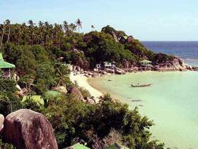
Tao' means turtle, and the island is named for its shape when seen from out in the waters of the gulf. Smaller than Samui and Pha-ngan, Ko Tao lies about 40 km north- west of Ko Pha-ngan, and is also easily accessible from Chumphon, directly west on the mainland. The island is particularly popular among divers, and has a reputation for some of the most exciting dive sites in the entire gulf. Several dive companies based at Mae Hat, the island's only town, can arrange dives for beginners and experienced divers.
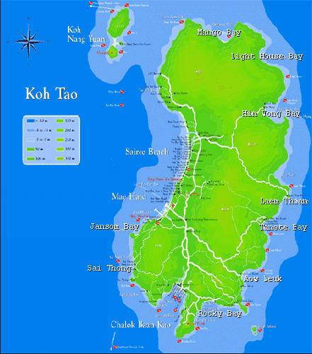
There are many peaceful and idyllic beaches on the island such as Hat Sai Ri, the island's longest beach on its west coast, Hat Chalok Ban Kao and Hat Sai Daeng on the south coast. There is also a unique geological phenomenon at Ko Nang Yuan, a tiny cluster of islets just off the north- west coast of Ko Tao, where stunning causeways of sand join the islands, offering visitors the choice of two seas to swim in. Ban Mae Hat
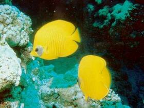
Diving and Snorkelling
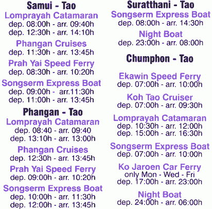
Kayaking Deep Sea or local fishing Walking Rock climbing - For the adventurous. There are courses available. Getting there. Train/Bus/Boat Combinations At Bangkok's Hualamphong station you can purchase train tickets that include a bus from the Surat Thani train station (Phun Phin) to the Ban Don pier and then a ferry to ko Pha-Ngan. These generally cost around 30 to 50 Baht more than buying each ticket separately yourself. Boat timetable.
Map of Koh Tao |