Thong Pha Phum National Park
|
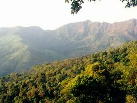
Thong Pha Phum National Park was designated under the Secretariat of the Cabinet policy to setting the defending of conservation and development forest, which far as Myanmar. The fertile forest was setting as sustain conservation forest, which has a large biodiversity.
The park cover Sri Sawat and Thong Pha Phum District which has 1,120 sq.km. of preparing national park forest.
Bi Teng Waterfall
Bi Teng Waterfall, which has water fall all the year round, has many ponds suitable for recreation and playing water. The weather is nicely cold. This area consists of productive forest so that there are many big trees and wilds animals inhabit all over the area. The way to get to the waterfall is not easy; traveler can go by car in summer but have to walk for a little while; and during rainy season traveler can only go by foot with 12 kilometers away from the nearest village.
Dip Yai Waterfall
Dip Yai Waterfall is situated next below Khao Yai Waterfall. Its stream, which has water all the year round, goes to meet the stream of Khao Yai Waterfall. The forest in this area is productive forest, which is the habitat of many kinds of animals. Traveler can use the same route of Khao Yai Waterfall to get there.
Huay Muang Waterfall
Huay Muang Waterfall has water falls all the year round. Some of the forest in this area has been destroyed because it locates in the area of mine. There is also a cave found, and has a laterite road, the road used together with and built by the mine company, 25 kilometers from E-pu Village.
Jok Ka Din Waterfall
a beautiful towering waterfall, which has stunning water flows over 30 m. high cliff. Walking from Ee Tong Village for a kilometer to visit there.
Khao Khad Viewpoint
closes to Jok Ka Din Waterfall. The highest elevation viewpoint from which we can admire panoramical surrounding forest and Jok Ka Din Waterfall.
Khao Noi Cave
located in Taling Daeng Village, Huay Khayeng Subdistrict, Thong Pha Phum District. Inside, ther is a Buddha image that is honorable by villager. Besides, the cave comprises of stalactite and stalagmite.
Khao Yai Waterfall
a big waterfall, with 3 levels. The surrounding forest is peaceful, suit for recreation. You have to walk through the nature trail for 4km. to the waterfall.
Km. 15 View Point
Located at Km. 15, Baanrai-Etong Road, the viewpoint is very near to the road, and has nicely cold air. Traveler can enjoy sceneries, for example, Khao Lam Reservoir, the very interesting scenery which is impressed by many visitors.
Nern Sao Thong
Nern Sao Thong is a mountain peak bordered Thailand and Burma which Thai Military stake a big flagstaff including a big Thai National Flag to show that this area is a border between Thailand and Burma. Therefore, this area is named Nern Sao Thong after the flagstaff (Sao thong means flagstaff). There are Thai Army and Border Police Officer giving security 24 hours a day, and allowed people to travel for enjoying the scenery and refreshing with nicely cold air. When standing there, traveler can see beautiful sceneries of both Thailand and Burma, and even Andaman Sea if the sky is clear.
|