|
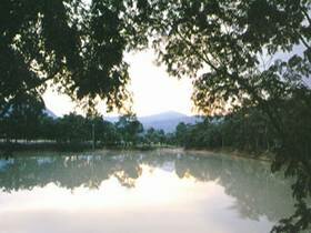
Thap Lan National Park was declared as Thailand's 40th National Park in December 1981. It is the country's second largest National Park, covering an area of 2,235.80 sq.km. The highest peak of the Park is Khao Lamang, at a height of 992 m above sea level. Thap Lan National Park extends across two provinces: Nakhon Ratchasima and Pranchin Buri. Park Headquarters are situated about 197 km from Bangkok. The Thap Lan area is comprised of continuous mountain ranges with naturally created valleys, chasms and waterfalls.
Thap Lan National Park is one of six related areas under the management of National Parks, Wildlife and Plant Conservation, which together constitute Queen Sirikit's Dong Phayayen-Khao Yai Forest Complex, in recognition of Her Majesty the Queen's 72nd birthday anniversary. The other five areas are Khao Yai National Park, Pangsida National Park; Ta Phraya National Park; Phraphutthachai National Park; and Dongyai Wildlife Sanctuary. See the relevant brochures for more information on each area.
The landscape is of big and small mountains lining in a large area. The highest peak is Khao Lamang with its height of 992 meters from the sea level. The continuous mountain ranges have naturally created valleys, chasms and waterfalls, which are the sources of rivers, such as Moon River and Bang Pakong River.
Bor Thong Waterfall
Locating in Buparam Sub-district, Nadi District, Prachin Buri Province, away from national road number 304 about 6 kilometers on road and 500 meters on foot, Bor Thong Waterfall is a very beautiful waterfall especially in the rains (form July to September), and has not much water in summer.
Fan Palm Forest
is the largest and last fan palm of Thailand. There are fan palm trees, which are an ancient plant that has flower clusters at the top when it is 20 years old. A fan palm tree produces more than 60 million flowers, after that it dies out.
Huai Khum Phu Waterfall
Turning off from national road number 304 about 20km to Thung Po Sub-district, Nadi District, Prachin Buri Province, visitor can see a cascade, called Huai Khun Phu Waterfall, watering a small dam below, and suitable for recreation.
Huai Yai Waterfall
Huai Yai Waterfall: is a beautiful and big waterfall. It is 50m high and 30m wide. The cliff at the waterfall looks like a 150-degree curve. The waterfall is at the Km.79 from the highway 304, and about 6km from the intersection at Km.79.
Lam Moon Bon Dam
About 20 meters beside national road number 304, Khon Buri District, Nakhon Ratchasima Province, Lam Moon Bon Dam is a soil dam, about 30 meters high, suitable for recreation.
Lam Plai Mart Dam
Locating 17 kilometers from Serng Sang District, there is a beautiful area called Hard Chom Tawan of Lam Plai Mart Dam which is an attraction of Amazing Thailand's year in cooperation between Thub Lan National Park and Serng Sang District in holding. There are boat for traveling, beaches for playing water, camping area and lodging house for family and grouped travelers.
Lam Prang
Lam Prang is 35 kilometers from Khon Buri District. The area is suitable for conservation traveling, such as, and for student to come camping, birding and studying other wild animal. The area has lodging house and camping area, and also has a route to get to Pang Sida National Park.
Makha Mountain
Khao Makha a locates in Udomsub Sub-district, Wang Nam Khao District, Nakhon Ratchasima Province, about 5 kilometers away from national road number 304. There is an up-mountain road which traveler can enjoy seeing scenery. The area is suitable for student to come to take visual education, has camping area and natural trail for exploring the wonderful mountain.
Suan Hom - Huai Kha Min - Huai Tai Yai Waterfall
Locating in Wang Nam Kheaw Sub-district, Wang Nam Kheaw District, Nakhon Ratchasima Province, about 6 kilometers away from national road number 304, the waterfall has a cliff 50 meters high and 30 meters wide and is very beautiful especially in the rains(form July to September), and has not much water in summer.
|