Tham Pla Namtok Pha Suea National Park
|
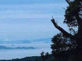
Tham Pla - Pha Sua National Park is situated in an approximate area of 488 square kilometers or 305,000 rai, covering the areas of Tham Pla - Pha Sua Waterfall in the right hand side of Mae-pai National Conserved Forest, Muang District, and Pang Ma-pha Sub-district. The topography of the National Park consist of high mountains extending northwards, which are the sources of streams and rivers. The natural sightseeing spots at the National Park consist of Tham Pla - Pha Sua Waterfall, which are beautiful and very popular for recreational activities.
The topography of the National Park consist of steep mountains. And Doi Lan is the highest mountaintop of the National Park (1,918 meters above the sea level). The north and the west of the National Park reaches Charn State of the Union of Myanmar; whereas, the south of the National Park reaches Huay Mhak-uen and Huay Peung of Muang District, Mae Hong Son Province; and the east of the National Park reaches the River of Pang Ma-pha Sub-district, Mae Hong Son Province.
Huay Pong-on Waterfall
The Waterfall is situated between the access road to Huay Pong-on village. The Waterfall is approximately 7 meters high and 5 meters wide and having the flowing water throughout the year. The Waterfall also has beautiful scenery and a small basin of 40 square meters for swimming.
Mae Sa-nga Klang Waterfall
Mae Sa-nga Klang Waterfall is a beautiful waterfall situated above Mae Sa-nga Dam, with the flowing water throughout the year. The Waterfall is approximately 15 meters high and 10 meters wide, and can be easily accessed by walking or by boat.
Mae Sa-nga Waterpower Dame
Mae Sa-nga Waterpower Dame is 37 meters high and 160 meters long, with its water retention capacity of 780,000 cubic meters. The scenery above the Dam is beautiful and suitable for recreation activities.
Pha Sua Waterfall
Pha Sua Waterfall is approximately 10 meters high and 15 meters wide. In the rainy season, the cliff is overflowed with rains and looks like a mat, therefore, the Waterfall is called "Pha Sua". In the dry season, you can watch beautiful rocks. The Waterfall is suitable for recreation actitivies.
Phra-bath Koo Cave or Jak-tok Cave
The Cave is situated on Doi Tham Pla and having beautiful stalagmites and stalactites and its entrance of approximately 5x8 meters wide. The Cave can only be accessed by walking, which will take you for approximately 1 hour.
Pla Cave
Tham Pla is a hillside cave with the flowing water throughout the year. You can watch a large school of blue-black fish called "Soro Brook Carp" or "Labeobarbus Soro". Tham Pla also has beautiful scenery of forests, cliffs, and limestone mountains.
|