|
The location of Mae Yom National Park has its high mountain ranges on both east and west part, which slope down to Yom River which flows through the middle of the area. The high mountain range is the source of water of many streams flowing to Yom River such as Huay Mae Pung, Huay Ded, Huay Pung, Huay Lerm, Huay Mae Tent, Huay Mae Sakin, and Huay Mae Pu.
Dong Sak Ngam
Dong Sak Ngam: looks like a group of teak densely gown up along the Yom River's side in the area of Mae Pung and Mae Pao Conservative National Parks. Teak grown up here is big, tall and beautiful. During October-November, you will face with shadiness and bright yellow teak flowers. Dong Sak Ngam is 6 Km. away from the office of the park.
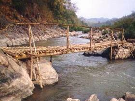
Kaeng Sua Ten
Kaeng Sua Ten: is a natural isle in Yom River with 4 Km. in length. The name Kaeng Sua Ten was given after a natural stone (on the isle) that bore footprints of a tiger. There are beaches around Kaeng Sua The, which are suitable for tent camping. This isle is located in front of the park office.
Lom Dong
Lom Dong: is a big natural water source, of which the diameter is about 100 m., located on a high mount, containing water the through year. It was supposed to be a hollowed ground of that area and has become the water source for the wild animals. Lom Dong is about 10 Km. away from the Headquarters.
|