Phu Kradueng National Park
|
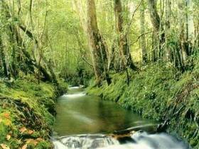
Phu Kradueng National Park, situated in Si Than Sub-district, Phu Kradueng District, Loei Province, has been designated as the 2nd national park of Thailand on November, 23, 1962. It covers an area of 348.12 Kilometers (217,575 rai) with 60 Kilometers (37,500 rai) of plateau on the top of mountain.
The elevation of Phu Kradueng is between 400-1,200 meters with the summit point of 1,316 meters at Khok Moei. In general, Phu Kradueng is the sandstone mountain consisting of an abundance of flora and fauna and the fullness of cliffs, savanna, streams and waterfalls other than that it is still the head watershed of Lam Nam Phong River which is one lf the most important rivers in Northeastern Thailand.
According to its high elevation and climatic condition, the weather on the mountaintop is cool all year round. Sometimes, in the winter. temperature may drop to freezing point. So, it is the most incentive to visitors who would like to be the Phu Kradueng conqueror at least once of their life.
Phu Kradung is a sandstone mountain with a vast plateau on top, surrounded by smaller hills. The highest peak is 1,316m above sea level. It is the watershed for the Pong River, which feeds the reservoir of Ubonrat Dam and Nong Wai Dam in Khon Kaen Province. The plateau of Phu Kradung is composed of pine forest and grassland, which have a variety of flowers, creeks, waterfalls and rocky fields. These features make in the park most pleasant.
Anodad Pool
is a small pool surrounded by pine trees. At one end, where the stream feeds in, is a rock that is good for sitting. From Anodad pool, there is a trail which leads to two caves.
Gaow Pool
is near the head of Thansawan stream. This pool is deep, but not very wide. The water is so clear that the bottom rock is visible. From this area there is a trail which leads through a flat rocky area scattered with "Reet" flowers, purple and yellow in color.
Penpobmai Waterfall
is a cascade over a sharp rock. In the cool season, maples will drop their red leaves to the water's surface. This is the source of anther waterfall, Penpob waterfall, named after a world champion boxer from Thailand who went to train at Phu Kradung in order to get used to cold weather before traveling abroad to temperate countries.
Pha Lomsak or Lomsak Cliff
About 9km from the Park Headquarters. There is a large overhaning rock stretches southward , overlooking the winding hills in Petchaboon Province. This is an excellent place for watching sunset.
Pha Nok Ann (Swallow Cliff)
is 2km east of the office. A single pine tree grows close to the edge of the cliff, where visitors like to watch the sun rise over the expansive fields and chain of mountains below. From here Pa Nok Kow can be clearly seen. Nearby is a large patch of rhodadendron growing among the rocks. These flowers bloom in March and April.
Pon-pob Waterfall
It is far from Pen-pob Waterfall only 600 meters. There are 8 levels and high 30 meters. It was believed that was found by Pon Kingpetch who was the first world champion boxer of Thailand.
Pra-ong Waterfall
It looks like Thanyai waterfall but smaller than. It is not big and falling from the cliff. There is water a whole year.
Tat Hong Waterfall
is part of Nampong Stream, which runs down the northeast side of the mountain. Both sides of this waterfall are steep rock and the deafening sound of the waterfall can be heard from far away. There are many other waterfalls, cliff, and points of interest. To fully enjoy the park, a minimum of three days is suggested for your visit.
Thamyai Waterfall
It is far from Pen-pob waterfall for a kilometer. For anybody who likes to touch the nature and se birds can come here because there are a lot of trees and can find a flower which has pink and yellow as well as maple trees. In January this area will be red because of the maple leaves.
Tran-sawan Waterfall
From Thanyai Waterfall walk to the junction toward Tran-sawan waterfall is only 106 kilometers from the accommodation.
Tum So-Tai Waterfall
It is the same and not far from So-nor Waterfall. It also was from the collapse of the land and not very famous.
Tum So-nor Waterfall
It is high 10 meters and there is only one level. It was from the collapse of the land. It also looks like Pen-pob Waterfall.
Wang-Kwang Waterfall
It is a waterfall where nearest the accommodation just only 750 meters away. It is not very high and looks like a hole down the hill. Nearby the forest, there are many deer so that this waterfall is called "Wang-Kwang Waterfall".
|